WE
ARE NOW LOCATED AT:
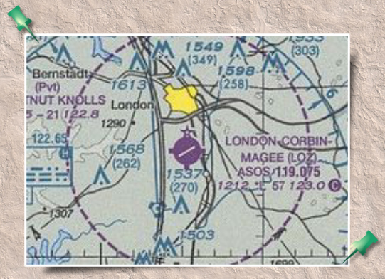
London-Corbin Airport-Magee Field
London, Kentucky, USA
| FAA Identifier: |
LOZ |
| Lat/Long: |
37-05-12.8000N / 084-04-38.6000W
37-05.213333N / 084-04.643333W
37.0868889 / -84.0773889
(estimated) |
| Elevation: |
1212 ft. / 369.4 m (surveyed) |
| Variation: |
05W (2005) |
| From city: |
3 miles S of LONDON, KY |
| Time zone: |
UTC -4 (UTC -5 during Standard Time) |
| Zip code: |
40744 |
Airport Operations
| Airport use: |
Open to the public |
| Activation date: |
10/1948 |
| Sectional chart: |
CINCINNATI |
| Control tower: |
no |
| ARTCC: |
INDIANAPOLIS CENTER |
| FSS: |
LOUISVILLE FLIGHT SERVICE STATION |
| NOTAMs facility: |
LOZ (NOTAM-D service available) |
| Attendance: |
SAT-SUN 0800-2000, ALL MON-FRI
0700-2000 |
| Wind indicator: |
yes |
| Segmented circle: |
yes |
| Lights: |
ACTVT MIRL RY 06/24 AND REIL RYS 06
& 24 - CTAF. |
| Beacon: |
white-green (lighted land airport)
Operates sunset to sunrise. |
Airport Communications
| CTAF/UNICOM: |
123.0 |
| WX ASOS: |
119.075 (606-877-1699) |
| WX AWOS-3 at BYL
(18 nm S): |
119.575 (606-549-1585) |
- APCH/DEP SVC PRVDD BY INDIANAPOLIS ARTCC ON
FREQS 124.625/371.925 (LONDON 2 RCAG).
Nearby radio navigation aids
| VOR radial/distance |
|
VOR name |
|
Freq |
|
Var |
| LOZr029/3.6 |
|
LONDON VORTAC |
|
116.10 |
|
03W |
Driving
Directions From
I-75 Exit 38:
Turn
east onto KY-192 E for 1.6 miles.
Turn right onto Corbin Rd. (US Hwy. 25) for 1.2
miles.
Turn right onto Airport Rd/Hal Rogers Drive.
Follow Hal Rogers Drive to the right toward Airport
Operations.
We are located
on the gated portion of the airport.
If you will call us, we will meet you at the gate.
If we are not
available, you can contact airport personnel and they will
escort you to our facility.
|


